Inferences
Looking at the Singapore River now, as well as the statues of the activities that happened during the pioneer's years, we inferred that people,
asian or european, had trading activities and people had jobs to do. We also saw a statue of some children jumping into the river, which we inferred that children liked to play in the river.
When we looked at the stairs leading to the river, we realised that the bottom of the stairs had been covered underwater, so we inferred that in the future, the water level would increase further.
Researched Information
The Singapore river was used for many things during the present and past. During the past, before Sir Stamford Raffles had discovered Singapore, Singapore was a fishing village name Temasek, meaning "Sea Town". As a fishing village, the inhabitants of Temasek, the Orang Laut, meaning "people of the sea", relied on the sea and thus lived around the mouth of the Singapore River. In 1818, Temenggong Abdul Rahman had arrived from Rhio to set up a village on the left bank of the river, and one year later, the treaty between him and Sir Stamford Raffles.
After Sir Thomas Stamford Raffles founded Singapore in 1819, the Singapore river was used as a trading area as a result of the low waters that trailed into central Singapore. As a result of all this use, there was a lot of rubbish and litter in the river. There were also street hawkers, pig and duck farms and vegetable wholesaling . The river also acted as a small port where boats were built and repaired. But after the opening of the Suez Canal in 1869, Singapore was able to attract more people to stop by, increasing its activities even more than it already was.
In year 1977, Lee Kuan Yew started a progamme to clean up the river and said "and in ten years let us have fishing in the Singapore River and Kallang River. It can be done." Following this programme, there was large development in housing, sewage as well as re-siting the hawkers into food courts. All the rubbish that was collected from the river was collected daily for incineration.
In the year 1987, the river was finally cleaned up and people could actually conduct recreational activities in the river such as fishing competitions, dragon boating as well as the annual duck race.
Sources:
Cornelius, T. (2000).
Singapore river: a historical review. Retrieved from: http://infopedia.nl.sg/articles/SIP_148_2005-02-02.html
Newasia-Singapore. (n.d.).
Brief History of Singapore. Retrieved from: http://www.newasia-singapore.com/travel_information/introduction/brief_history_of_singapore_200705304.html
Barbara, S. N. (n.d.).
Selung/Moken. Retrieved from: http://www.everyculture.com/East-Southeast-Asia/Selung-Moken.html
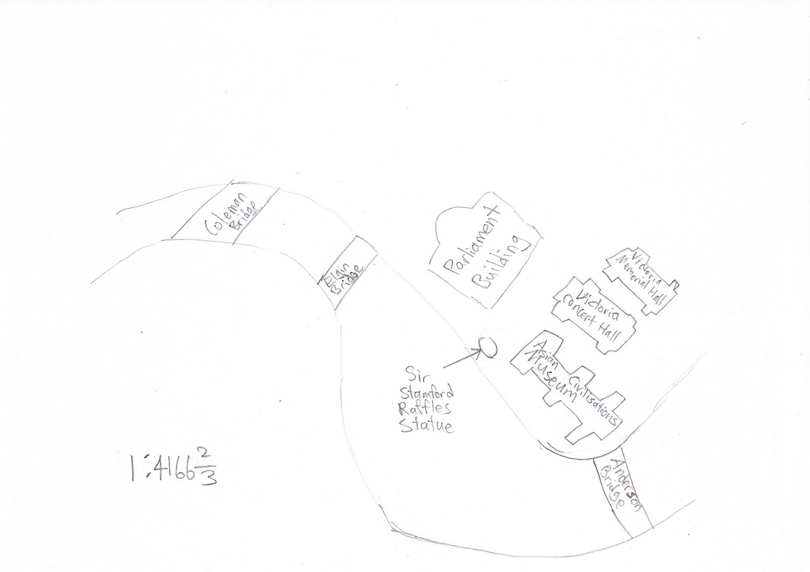
The scale is 1:4166 2/3 (Our scaled map along the Singapore River, from Coleman Bridge to Anderson Bridge)